Neco Model Questions Vol1 2020 Geography Question 1
Practice essay / theory question 1 from the 2020 Neco Model Questions Vol1 Geography examination. This question covers Map Reading, Scale .
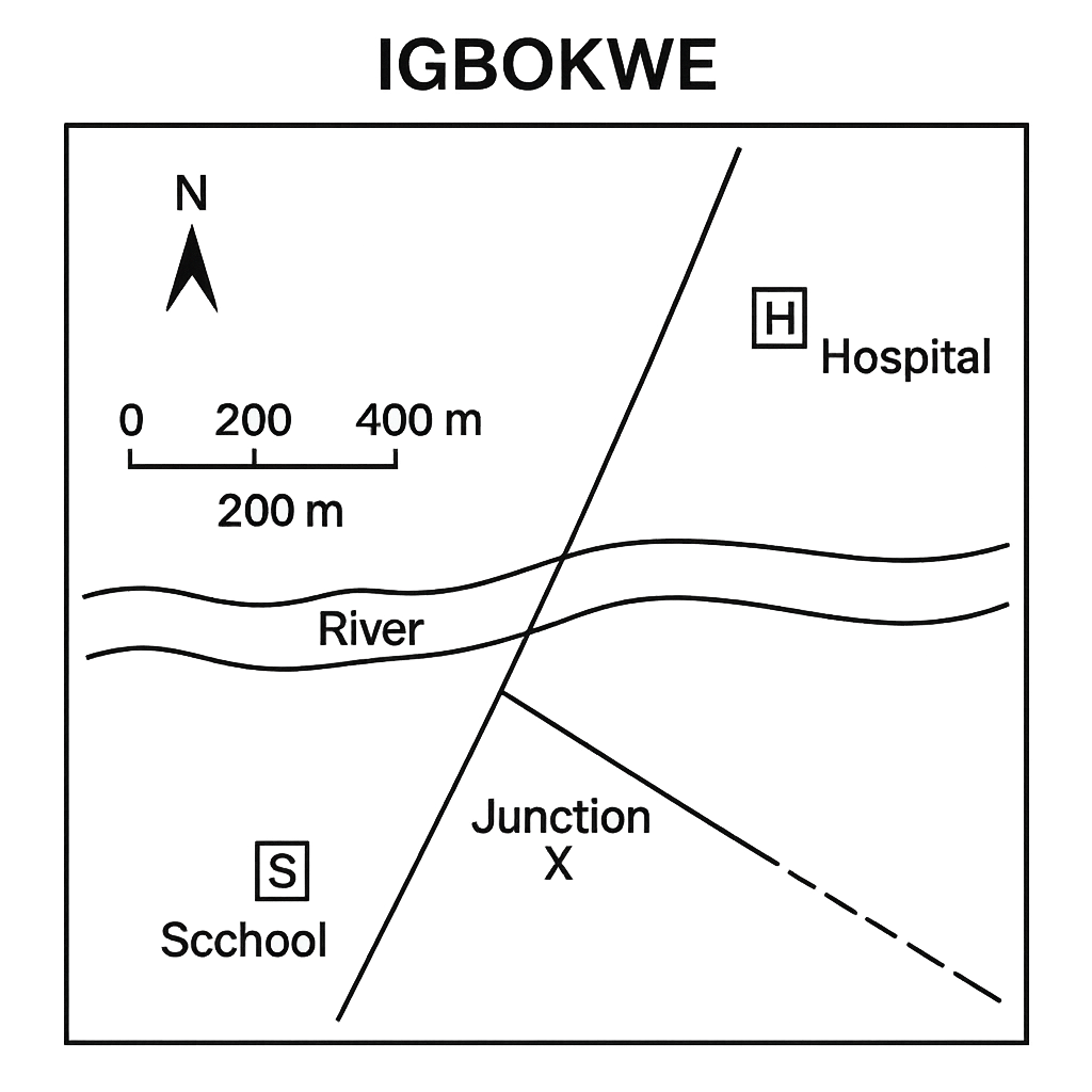
The diagram shows a simplified map of the town of Igbokwe. The map includes a north arrow, a scale bar (1 cm = 200 m) and the following symbols: a school (S), a hospital (H), a river (R) and two roads – Road A (solid line) and Road B (dashed line). On the map the straight‑line distance between the school and the hospital measures 3.5 cm with a ruler. The route that a pedestrian would follow from the school to the hospital along the roads consists of two segments: from the school to the road junction X is 2.0 cm and from X to the hospital is 2.5 cm. The bearing of the line joining the school to the hospital, measured clockwise from the north arrow on the map, is 45°. Answer the following questions:
Question Parts
Detailed Solution & Marking Scheme
Get the step-by-step solution, key points required by examiners and detailed marking guidance through the Edcrib AI Tutor.
Reveal AnswerAbout This Question
This is Neco Model Questions Vol1 2020 Geography Question 1. It is one of the essay questions from the 2020 Neco Model Questions Vol1 Geography examination.
The question covers Map Reading, Scale .
Master the Exam!
You've seen a preview, but there are thousands more questions plus AI tutor to break down complex solutions.