Neco Model Questions Vol1 2017 Geography Question 2

Practice essay / theory question 2 from the 2017 Neco Model Questions Vol1 Geography examination. This question covers Scale .
Neco Model Questions Vol1 2017 Geography Essay / Theory
Topic: Scale
Question 2 NECO_MODEL_QUESTIONS_VOL1 • 2017 • GEOGRAPHY • essay

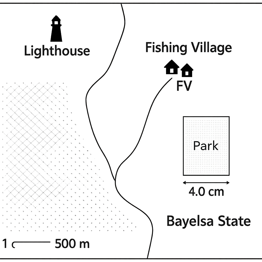
A tourist map of the coastal region of Bayelsa State is shown. The map scale is 1 cm = 500 m.

Question Parts

( a )
The distance between the lighthouse and the fishing village is 6.2 cm on the map. Find the actual distance in kilometres.
( b )
If a new map of the same area is to be drawn at a scale of 1 cm = 250 m, what will be the length in centimetres of the lighthouse‑fishing‑village distance on the new map?
( c )
The map shows a rectangular park whose length measures 4.0 cm and width 2.5 cm. Calculate the real area of the park in hectares on the original map scale.
( d )
A proposed road will cut across the park diagonally. Using the original scale, determine the actual length of the road in metres. (Use Pythagoras).

Detailed Solution & Marking Scheme

Get the step-by-step solution, key points required by examiners and detailed marking guidance through the Edcrib AI Tutor.

Reveal Answer

About This Question

This is Neco Model Questions Vol1 2017 Geography Question 2. It is one of the essay questions from the 2017 Neco Model Questions Vol1 Geography examination.

The question covers Scale .

Master the Exam!

You've seen a preview, but there are thousands more questions plus AI tutor to break down complex solutions.

Unlock Full Access Available for Android & Windows
Chat with Support