Neco 2019 Geography Question 1
Practice essay / theory question 1 from the 2019 Neco Geography examination. This question covers Map Reading, Scale conversion, Compass directions .
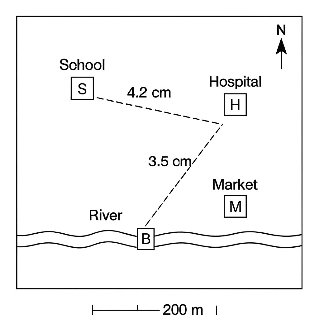
A schematic map of a town is provided. The map scale is 1 cm = 200 metres. The map shows the following landmarks: School (S), Hospital (H), Market (M), River (R) and a Bridge (B). The straight‑line distances measured on the map are: S–H = 4.2 cm, S–M = 3.5 cm, and S–B = 2.0 cm. The compass rose on the map indicates that north is at the top and the River lies directly south of the School.
Question Parts
Detailed Solution & Marking Scheme
Get the step-by-step solution, key points required by examiners and detailed marking guidance through the Edcrib AI Tutor.
Reveal AnswerAbout This Question
This is Neco 2019 Geography Question 1. It is one of the essay questions from the 2019 Neco Geography examination.
The question covers Map Reading, Scale conversion, Compass directions .
Master the Exam!
You've seen a preview, but there are thousands more questions plus AI tutor to break down complex solutions.