Gce Model Questions Vol1 2023 Geography Question 3
Practice essay / theory question 3 from the 2023 Gce Model Questions Vol1 Geography examination. This question covers Latitude and Longitude, Map projection, Geographical position and climate .
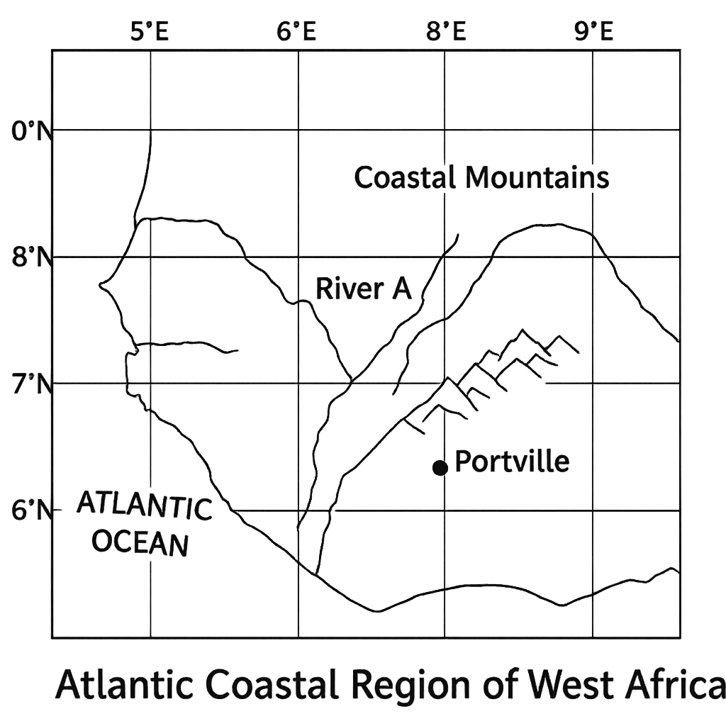
The map shown represents a portion of the Atlantic coastal region of West Africa. Latitude lines are drawn at 5°N, 6°N, 7°N, 8°N, 9°N and 10°N and longitude lines at 5°E, 6°E, 7°E, 8°E, 9°E and 10°E. The major settlement Portville is marked at the intersection of the 7°30'N latitude line and the 8°15'E longitude line. River A flows from the point (6°N, 7°E) to (9°N, 9°E). The coastal mountain range lies roughly between 8°N and 9°N and extends from 8°E to 10°E. The map is drawn using a Mercator projection. Answer the following questions:
Question Parts
Detailed Solution & Marking Scheme
Get the step-by-step solution, key points required by examiners and detailed marking guidance through the Edcrib AI Tutor.
Reveal AnswerAbout This Question
This is Gce Model Questions Vol1 2023 Geography Question 3. It is one of the essay questions from the 2023 Gce Model Questions Vol1 Geography examination.
The question covers Latitude and Longitude, Map projection, Geographical position and climate .
Master the Exam!
You've seen a preview, but there are thousands more questions plus AI tutor to break down complex solutions.