Waec Model Questions Vol1 2020 Geography Question 1
Practice essay / theory question 1 from the 2020 Waec Model Questions Vol1 Geography examination. This question covers Map Reading, Scale, Contour interpretation .
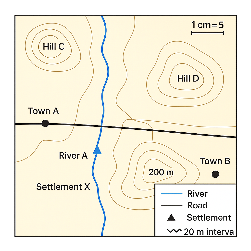
The map shown represents a portion of the Niger Delta region. The map scale is 1 cm = 5 km. The legend indicates that a blue line denotes a river, a solid black line denotes a road, a filled triangle denotes a settlement, and contour lines are drawn at 20‑m intervals. River A enters the map from the north, flows past Settlement X and joins River B which runs east‑west. The contour line passing through Hill C is marked 120 m and the line through Hill D is marked 200 m.
Question Parts
Detailed Solution & Marking Scheme
Get the step-by-step solution, key points required by examiners and detailed marking guidance through the Edcrib AI Tutor.
Reveal AnswerAbout This Question
This is Waec Model Questions Vol1 2020 Geography Question 1. It is one of the essay questions from the 2020 Waec Model Questions Vol1 Geography examination.
The question covers Map Reading, Scale, Contour interpretation .
Master the Exam!
You've seen a preview, but there are thousands more questions plus AI tutor to break down complex solutions.